Tilted Mesa Morning Glory Middle Earth loop
- Distance: 4.8 Km
- Elevation gain: 129 m
- Maximum elevation: 1,641 m
- Elevation loss: 130 m
- Minimum elevation: 1,559 m
- Moving time: 32 m 39 s
- Moving speed: 8.9 Km/h
- Maximum speed: 22.7 Km/h
- Total time: 32 m 39 s
- Global speed: 8.9 Km/h
Interactive trail map
Trail profile
- Distance: 4.8 Km
- Elevation gain: 129 m
- Maximum elevation: 1,641 m
- Elevation loss: 130 m
- Minimum elevation: 1,559 m
- Moving time: 32 m 39 s
- Moving speed: 8.9 Km/h
- Maximum speed: 22.7 Km/h
- Total time: 32 m 39 s
- Global speed: 8.9 Km/h
About this trail
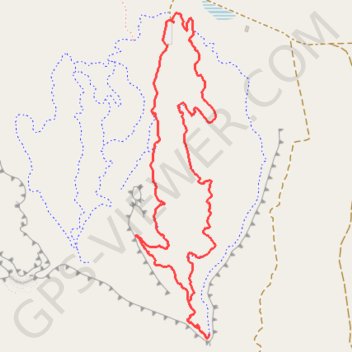
Name: Tilted Mesa Morning Glory Middle Earth loop trail, distance, elevation, map, profile, GPS track
Start: Escape Wash, Kane County, Utah, United States (37.02249 -112.35249)
End: Escape Wash, Kane County, Utah, United States (37.02252 -112.35254)
Coordinates: 37.00932 -112.35447 37.02284 -112.35032
Other hiking, mountain biking, running and outdoor activity trails
Click on a trail to view its statistics, map and profile.
Tilted Mesa
United States > Utah > Kane County
Distance: 12.0 Km • Elevation gain: 262 m • Maximum elevation: 1,642 m