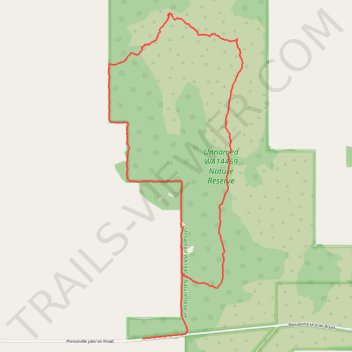
Jaloran
- Distance: 6.9 Km
- Elevation gain: 72 m
- Maximum elevation: 388 m
- Elevation loss: 75 m
- Minimum elevation: 345 m
- Moving time: 1 h 44 m
- Moving speed: 4.0 Km/h
- Maximum speed: 27.9 Km/h
- Total time: 3 h 7 m
- Global speed: 2.2 Km/h
Interactive trail map
Trail profile
- Distance: 6.9 Km
- Elevation gain: 72 m
- Maximum elevation: 388 m
- Elevation loss: 75 m
- Minimum elevation: 345 m
- Moving time: 1 h 44 m
- Moving speed: 4.0 Km/h
- Maximum speed: 27.9 Km/h
- Total time: 3 h 7 m
- Global speed: 2.2 Km/h
About this trail
Name: Jaloran trail, distance, elevation, map, profile, GPS track
Coordinates: -33.16620 117.35987 -33.14437 117.37063
Topography: Western Australia topographic map, elevation, terrain