Chapel Rock Trail, North Country Trail and Mosquito River Trail Loop in Pictured Rocks National Lakeshore
This loop is a must for nature lovers seeking expansive views of Lake Superior, dramatic cliffs, and unique rock formations. Starting through lush forests, the trail reveals Chapel Falls and the iconic Chapel Rock, a sandstone formation crowned with a lone tree—a marvel of natural resilience. Grand Portal Point offers breathtaking vistas along the lake, while Miner's Castle Overlook provides a final rewarding view over the colorful sandstone cliffs, making this trail one of the most scenic in the Upper Peninsula. #Hiking #Loop #Waterfall #Lake #Rock #Forest #Nature
- Distance: 15.6 Km
- Elevation gain: 425 m
- Maximum elevation: 256 m
- Elevation loss: 426 m
- Minimum elevation: 181 m
- Moving time: 3 h 45 m
- Moving speed: 4.2 Km/h
- Maximum speed: 7.8 Km/h
- Total time: 4 h 37 s
- Global speed: 3.9 Km/h
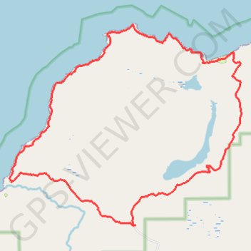
Interactive trail map
Trail profile
- Distance: 15.6 Km
- Elevation gain: 425 m
- Maximum elevation: 256 m
- Elevation loss: 426 m
- Minimum elevation: 181 m
- Moving time: 3 h 45 m
- Moving speed: 4.2 Km/h
- Maximum speed: 7.8 Km/h
- Total time: 4 h 37 s
- Global speed: 3.9 Km/h
About this trail
Name: Chapel Rock Trail, North Country Trail and Mosquito River Trail Loop in Pictured Rocks National Lakeshore trail, distance, elevation, map, profile, GPS track
Start: Chapel Road, Munising Township, Alger County, Michigan, United States (46.51967 -86.46169)
End: Chapel Road, Munising Township, Alger County, Michigan, United States (46.51958 -86.46214)
Coordinates: 46.51958 -86.49239 46.55323 -86.43591
Other hiking, mountain biking, running and outdoor activity trails
Click on a trail to view its statistics, map and profile.
Chapel Loop hiking
United States > Michigan > Alger County
Distance: 16.5 Km • Elevation gain: 448 m • Maximum elevation: 256 m