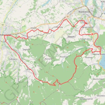
Trasa z 49.853114N, 19.343233E do 49.853100N, 19.343201E
- Distance: 48.9 Km
- Elevation gain: 1,049 m
- Maximum elevation: 849 m
- Elevation loss: 1,049 m
- Minimum elevation: 266 m
Interactive trail map
Trail profile
- Distance: 48.9 Km
- Elevation gain: 1,049 m
- Maximum elevation: 849 m
- Elevation loss: 1,049 m
- Minimum elevation: 266 m
About this trail
Name: Trasa z 49.853114N, 19.343233E do 49.853100N, 19.343201E trail, distance, elevation, map, profile, GPS track
Coordinates: 49.79390 19.34235 49.87430 19.52441