
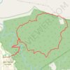
Groeneweide, the Godfather and Tierkop loop hike from NMU George Campus
- Distance: 18.4 Km
- Elevation gain: 870 m
- Maximum elevation: 609 m
- Elevation loss: 870 m
- Minimum elevation: 120 m
- Moving time: 2 h 26 m
- Moving speed: 7.5 Km/h
- Maximum speed: 16.7 Km/h
- Total time: 2 h 30 m
- Global speed: 7.3 Km/h
Interactive trail map
Trail profile
- Distance: 18.4 Km
- Elevation gain: 870 m
- Maximum elevation: 609 m
- Elevation loss: 870 m
- Minimum elevation: 120 m
- Moving time: 2 h 26 m
- Moving speed: 7.5 Km/h
- Maximum speed: 16.7 Km/h
- Total time: 2 h 30 m
- Global speed: 7.3 Km/h
About this trail

Name: Groeneweide, the Godfather and Tierkop loop hike from NMU George Campus trail, distance, elevation, map, profile, GPS track
Coordinates: -33.95899 22.51583 -33.91558 22.55582
Other hiking, mountain biking, running and outdoor activity trails
Click on a trail to view its statistics, map and profile.
Groeneweide red route hiking trail
South Africa > Western Cape > George
Distance: 13.2 Km • Elevation gain: 428 m • Maximum elevation: 313 m