Thank you for supporting this site ❤️
Make a donation
Make a donation
Gear up for your next adventure:
As an Amazon Associate, this site earns from qualifying purchases at no extra cost to you.
Dye Creek Greenway and Bellingham Park
- Distance: 9.4 Km
- Elevation gain: 102 m
- Maximum elevation: 253 m
- Elevation loss: 101 m
- Minimum elevation: 215 m
- Moving time: 1 h 2 m
- Moving speed: 9.0 Km/h
- Maximum speed: 15.3 Km/h
- Total time: 1 h 2 m
- Global speed: 9.0 Km/h
Interactive trail map
Thank you for supporting this site ❤️
Make a donation
Make a donation
Gear up for your next adventure:
As an Amazon Associate, this site earns from qualifying purchases at no extra cost to you.
Trail profile
- Distance: 9.4 Km
- Elevation gain: 102 m
- Maximum elevation: 253 m
- Elevation loss: 101 m
- Minimum elevation: 215 m
- Moving time: 1 h 2 m
- Moving speed: 9.0 Km/h
- Maximum speed: 15.3 Km/h
- Total time: 1 h 2 m
- Global speed: 9.0 Km/h
Thank you for supporting this site ❤️
Make a donation
Make a donation
Gear up for your next adventure:
As an Amazon Associate, this site earns from qualifying purchases at no extra cost to you.
About this trail
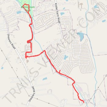
Name: Dye Creek Greenway and Bellingham Park trail, distance, elevation, map, profile, GPS track
Coordinates: 35.52432 -80.80076 35.54942 -80.78168
Thank you for supporting this site ❤️
Make a donation
Make a donation
Gear up for your next adventure:
As an Amazon Associate, this site earns from qualifying purchases at no extra cost to you.