Grapevine Wash and other trails
- Distance: 11.1 Km
- Elevation gain: 166 m
- Maximum elevation: 1,119 m
- Elevation loss: 277 m
- Minimum elevation: 889 m
- Moving time: 2 h 45 m
- Moving speed: 4.0 Km/h
- Maximum speed: 8.3 Km/h
- Total time: 3 h 19 m
- Global speed: 3.3 Km/h
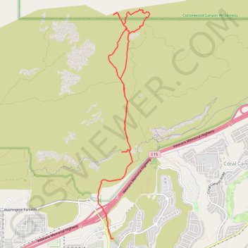
Interactive trail map
Trail profile
- Distance: 11.1 Km
- Elevation gain: 166 m
- Maximum elevation: 1,119 m
- Elevation loss: 277 m
- Minimum elevation: 889 m
- Moving time: 2 h 45 m
- Moving speed: 4.0 Km/h
- Maximum speed: 8.3 Km/h
- Total time: 3 h 19 m
- Global speed: 3.3 Km/h
About this trail
Name: Grapevine Wash and other trails trail, distance, elevation, map, profile, GPS track
Start: Dino Cliffs, Washington, Washington County, Utah, 84780, United States (37.15901 -113.48214)
Coordinates: 37.14291 -113.48773 37.18567 -113.47557
Other hiking, mountain biking, running and outdoor activity trails
Click on a trail to view its statistics, map and profile.
Grapevine, Church Rocks, Spanish Wash and Bracken's Trails Loop in Red Cliffs National Conservation Area
United States > Utah > Washington County > Washington
Distance: 17.1 Km • Elevation gain: 336 m • Maximum elevation: 1,101 m