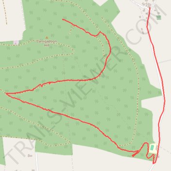
Carrickadoon
- Distance: 4.9 Km
- Elevation gain: 72 m
- Maximum elevation: 256 m
- Elevation loss: 225 m
- Minimum elevation: 63 m
- Moving time: 50 m 17 s
- Moving speed: 5.9 Km/h
- Maximum speed: 52.3 Km/h
- Total time: 58 m 33 s
- Global speed: 5.1 Km/h
Interactive trail map
Trail profile
- Distance: 4.9 Km
- Elevation gain: 72 m
- Maximum elevation: 256 m
- Elevation loss: 225 m
- Minimum elevation: 63 m
- Moving time: 50 m 17 s
- Moving speed: 5.9 Km/h
- Maximum speed: 52.3 Km/h
- Total time: 58 m 33 s
- Global speed: 5.1 Km/h
About this trail
Name: Carrickadoon trail, distance, elevation, map, profile, GPS track
Coordinates: 52.40129 -7.41252 52.41328 -7.39263