Import a GPX file

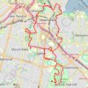
Shiny Party - Auckland - GPX Route

  • Distance: 14.2 Km
  • Elevation gain: 291 m
  • Maximum elevation: 82 m
  • Elevation loss: 302 m
  • Minimum elevation: 11 m

Interactive trail map

Trail profile

  • Distance: 14.2 Km
  • Elevation gain: 291 m
  • Maximum elevation: 82 m
  • Elevation loss: 302 m
  • Minimum elevation: 11 m

About this trail

Other hiking, mountain biking, running and outdoor activity trails

Click on a trail to view its statistics, map and profile.

Auckland Domain

New Zealand > Auckland > Auckland

#Hiking #Loop

Distance: 4.5 Km • Elevation gain: 145 m • Maximum elevation: 74 m

Mount Hobson - Mount Saint John - Mount Eden

New Zealand > Auckland > Auckland

Auckland. #Hiking #Loop

Distance: 20.6 Km • Elevation gain: 522 m • Maximum elevation: 182 m

Auckland Domain

New Zealand > Auckland > Auckland

#Hiking #Loop

Distance: 3.0 Km • Elevation gain: 52 m • Maximum elevation: 84 m

Gear up for your next adventure:

🏕️Camping Gear - Essential camping equipment
🧺Fast-Dry Microfiber Towels - Large towels that pack down to the size of an orange
🎒Tactical Waist Packs - Quick access to your compass, phone, and snacks while walking
📡Weather Radios - Emergency weather radios
🪑Portable Backpacking Chairs - A comfortable seat for studying maps at the end of the day

As an Amazon Associate, this site earns from qualifying purchases at no extra cost to you.