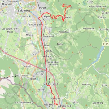
Route von Oberalm nach/zu Gaisberg (1287 m)
- Distance: 22.5 Km
- Elevation gain: 910 m
- Maximum elevation: 1,286 m
- Elevation loss: 78 m
- Minimum elevation: 420 m
Interactive trail map
Trail profile
- Distance: 22.5 Km
- Elevation gain: 910 m
- Maximum elevation: 1,286 m
- Elevation loss: 78 m
- Minimum elevation: 420 m
About this trail
Name: Route von Oberalm nach/zu Gaisberg (1287 m) trail, distance, elevation, map, profile, GPS track
Start: 30, Hammerstraße, Oberalm, Bezirk Hallein, Salzburg, 5411, Austria (47.69334 13.10218)
Coordinates: 47.69325 13.07038 47.80512 13.12361