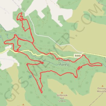
Kinnitty Forest MTB Loop
- Distance: 25.2 Km
- Elevation gain: 608 m
- Maximum elevation: 357 m
- Elevation loss: 609 m
- Minimum elevation: 205 m
- Moving time: 1 h 59 m
- Moving speed: 12.7 Km/h
- Maximum speed: 35.5 Km/h
- Total time: 2 h 16 m
- Global speed: 11.1 Km/h
Interactive trail map
Trail profile
- Distance: 25.2 Km
- Elevation gain: 608 m
- Maximum elevation: 357 m
- Elevation loss: 609 m
- Minimum elevation: 205 m
- Moving time: 1 h 59 m
- Moving speed: 12.7 Km/h
- Maximum speed: 35.5 Km/h
- Total time: 2 h 16 m
- Global speed: 11.1 Km/h
About this trail
Name: Kinnitty Forest MTB Loop trail, distance, elevation, map, profile, GPS track
Coordinates: 53.07372 -7.67850 53.10726 -7.61051