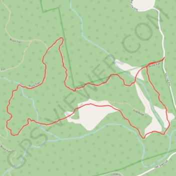
Hockley Valley Provincial Park
- Distance: 4.0 Km
- Elevation gain: 109 m
- Maximum elevation: 392 m
- Elevation loss: 109 m
- Minimum elevation: 318 m
Interactive trail map
Trail profile
- Distance: 4.0 Km
- Elevation gain: 109 m
- Maximum elevation: 392 m
- Elevation loss: 109 m
- Minimum elevation: 318 m
About this trail
Name: Hockley Valley Provincial Park trail, distance, elevation, map, profile, GPS track
Coordinates: 43.98789 -80.06088 43.99378 -80.04761
Other hiking, mountain biking, running and outdoor activity trails
Click on a trail to view its statistics, map and profile.
Ontario country roads
Distance: 150.4 Km • Elevation gain: 1,137 m • Maximum elevation: 497 m