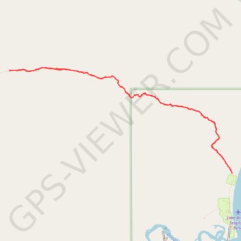
Dumpling Mountain Trail
- Distance: 7.6 Km
- Elevation gain: 453 m
- Maximum elevation: 468 m
- Elevation loss: 454 m
- Minimum elevation: 19 m
- Moving time: 2 h 17 m
- Moving speed: 3.3 Km/h
- Maximum speed: 5.3 Km/h
- Total time: 2 h 51 m
- Global speed: 2.7 Km/h
Interactive trail map
Trail profile
- Distance: 7.6 Km
- Elevation gain: 453 m
- Maximum elevation: 468 m
- Elevation loss: 454 m
- Minimum elevation: 19 m
- Moving time: 2 h 17 m
- Moving speed: 3.3 Km/h
- Maximum speed: 5.3 Km/h
- Total time: 2 h 51 m
- Global speed: 2.7 Km/h
About this trail
Name: Dumpling Mountain Trail trail, distance, elevation, map, profile, GPS track
Start: Dumpling Mountain Trail, Lake and Peninsula, Alaska, United States (58.56105 -155.77814)
End: Dumpling Mountain Trail, Lake and Peninsula, Alaska, United States (58.56080 -155.77801)
Coordinates: 58.56080 -155.82312 58.57196 -155.77801