Douglas County Gravel/Unpaved Cycling
- Distance: 44.6 Km
- Elevation gain: 701 m
- Maximum elevation: 1,938 m
- Elevation loss: 701 m
- Minimum elevation: 1,809 m
- Moving time: 2 h 32 m
- Moving speed: 17.5 Km/h
- Maximum speed: 47.2 Km/h
- Total time: 2 h 44 m
- Global speed: 16.2 Km/h
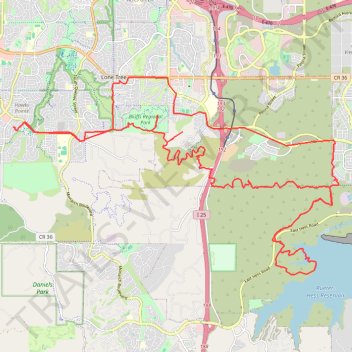
Interactive trail map
Trail profile
- Distance: 44.6 Km
- Elevation gain: 701 m
- Maximum elevation: 1,938 m
- Elevation loss: 701 m
- Minimum elevation: 1,809 m
- Moving time: 2 h 32 m
- Moving speed: 17.5 Km/h
- Maximum speed: 47.2 Km/h
- Total time: 2 h 44 m
- Global speed: 16.2 Km/h
About this trail
Name: Douglas County Gravel/Unpaved Cycling trail, distance, elevation, map, profile, GPS track
Coordinates: 39.48454 -104.93823 39.53633 -104.82760
Other hiking, mountain biking, running and outdoor activity trails
Click on a trail to view its statistics, map and profile.
Douglas County Gravel/Unpaved Cycling
United States > Colorado > Douglas County
Gravel cycling route
Distance: 73.4 Km • Elevation gain: 728 m • Maximum elevation: 1,923 m
Rueter Hess Reservoir
United States > Colorado > Douglas County > Lone Tree
mtb mountainbiking biking trails
Distance: 40.0 Km • Elevation gain: 718 m • Maximum elevation: 2,011 m