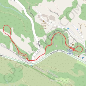
Redwood Valley Railway
- Distance: 1.9 Km
- Elevation gain: 32 m
- Maximum elevation: 506 m
- Elevation loss: 31 m
- Minimum elevation: 481 m
- Moving time: 17 m 12 s
- Moving speed: 6.8 Km/h
- Maximum speed: 36.9 Km/h
- Total time: 17 m 12 s
- Global speed: 6.8 Km/h
Interactive trail map
Trail profile
- Distance: 1.9 Km
- Elevation gain: 32 m
- Maximum elevation: 506 m
- Elevation loss: 31 m
- Minimum elevation: 481 m
- Moving time: 17 m 12 s
- Moving speed: 6.8 Km/h
- Maximum speed: 36.9 Km/h
- Total time: 17 m 12 s
- Global speed: 6.8 Km/h
About this trail
Name: Redwood Valley Railway trail, distance, elevation, map, profile, GPS track
Coordinates: 37.87976 -122.22838 37.88199 -122.22210