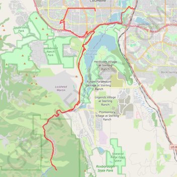
Waterton Canyon
- Distance: 57.4 Km
- Elevation gain: 748 m
- Maximum elevation: 1,834 m
- Elevation loss: 704 m
- Minimum elevation: 1,630 m
Interactive trail map
Trail profile
- Distance: 57.4 Km
- Elevation gain: 748 m
- Maximum elevation: 1,834 m
- Elevation loss: 704 m
- Minimum elevation: 1,630 m
About this trail
Name: Waterton Canyon trail, distance, elevation, map, profile, GPS track
Coordinates: 39.43034 -105.13536 39.58204 -105.02566
Other hiking, mountain biking, running and outdoor activity trails
Click on a trail to view its statistics, map and profile.
Littleton Gravel/Unpaved Cycling
United States > Colorado > Arapahoe County > Littleton
Distance: 57.2 Km • Elevation gain: 313 m • Maximum elevation: 1,710 m