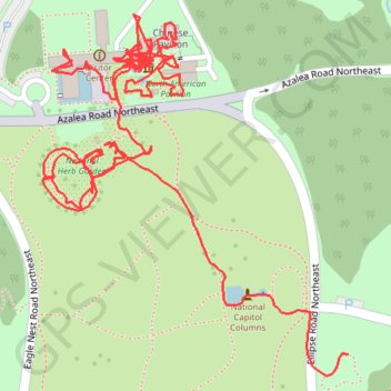
National Herb Garden
- Distance: 2.7 Km
- Elevation gain: 15 m
- Maximum elevation: 25 m
- Elevation loss: 16 m
- Minimum elevation: 16 m
Interactive trail map
Trail profile
- Distance: 2.7 Km
- Elevation gain: 15 m
- Maximum elevation: 25 m
- Elevation loss: 16 m
- Minimum elevation: 16 m
About this trail
Name: National Herb Garden trail, distance, elevation, map, profile, GPS track
Coordinates: 38.90943 -76.97025 38.91292 -76.96646