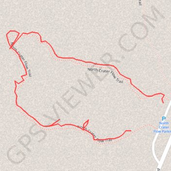
North Crater Flow Trail
Craters of the Moon National Monument
- Distance: 0.6 Km
- Elevation gain: 5 m
- Maximum elevation: 1,791 m
- Elevation loss: 4 m
- Minimum elevation: 1,785 m
Interactive trail map
Trail profile
- Distance: 0.6 Km
- Elevation gain: 5 m
- Maximum elevation: 1,791 m
- Elevation loss: 4 m
- Minimum elevation: 1,785 m
About this trail
Name: North Crater Flow Trail trail, distance, elevation, map, profile, GPS track
Start: North Crater Flow Trail, Butte County, Idaho, United States (43.45738 -113.55918)
End: North Crater Flow Trail, Butte County, Idaho, United States (43.45769 -113.55868)
Coordinates: 43.45728 -113.56111 43.45850 -113.55866