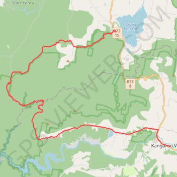
Fitzroy Falls - Meryla Pass - Kangaroo Valley
Interactive trail map
Trail profile
- Distance: 37.9 Km
- Elevation gain: 590 m
- Maximum elevation: 690 m
- Elevation loss: 1,161 m
- Minimum elevation: 74 m
About this trail
Name: Fitzroy Falls - Meryla Pass - Kangaroo Valley trail, distance, elevation, map, profile, GPS track
Coordinates: -34.73632 150.37892 -34.64552 150.53374
Topography: New South Wales topographic map, elevation, terrain
Other hiking, mountain biking, running and outdoor activity trails
Click on a trail to view its statistics, map and profile.
Ulladulla - Minnamurra
Australia > New South Wales > Burrill Lake
#Bike
Distance: 127.8 Km • Elevation gain: 1,627 m • Maximum elevation: 143 m