Import a GPX file

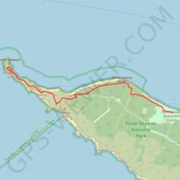
Coles Track - Cheviot Hill - Fort Nepean

Point Nepean National Park. #Hiking #Nepean

  • Distance: 5.1 Km
  • Elevation gain: 90 m
  • Maximum elevation: 41 m
  • Elevation loss: 93 m
  • Minimum elevation: 2 m
  • Moving time: 1 h 8 m
  • Moving speed: 4.5 Km/h
  • Maximum speed: 14.4 Km/h
  • Total time: 1 h 23 m
  • Global speed: 3.7 Km/h

Interactive trail map

Trail profile

  • Distance: 5.1 Km
  • Elevation gain: 90 m
  • Maximum elevation: 41 m
  • Elevation loss: 93 m
  • Minimum elevation: 2 m
  • Moving time: 1 h 8 m
  • Moving speed: 4.5 Km/h
  • Maximum speed: 14.4 Km/h
  • Total time: 1 h 23 m
  • Global speed: 3.7 Km/h

About this trail

Other hiking, mountain biking, running and outdoor activity trails

Click on a trail to view its statistics, map and profile.

Fort Nepean - Mornington Peninsula

Australia > Victoria > Melbourne

#Hiking #Loop #Nepean

Distance: 8.1 Km • Elevation gain: 189 m • Maximum elevation: 41 m

Point Nepean National Park

Australia > Victoria > Melbourne

Distance: 63.6 Km • Elevation gain: 669 m • Maximum elevation: 42 m

Gear up for your next adventure:

🏫Topographic World Globes - 3D physical relief globes to understand global geography
🌧️Rain Jackets - Waterproof jackets for hiking
🧥Down Jackets - Insulated jackets for cold weather
🚁Camera Drones with GPS - Capture aerial views of the landscape to compare with topo maps
🔦Powerful LED Headlamps - Hands-free lighting for night navigation and setting up camp after dark

As an Amazon Associate, this site earns from qualifying purchases at no extra cost to you.