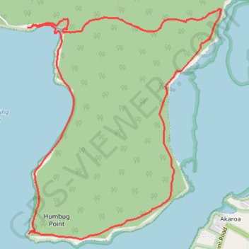
Humbug Point Loop
Humbug Point Nature Recreation Area. Georges Bay. #Hiking #Loop #HumbugPoint #Tasmania
- Distance: 10.0 Km
- Elevation gain: 212 m
- Maximum elevation: 83 m
- Elevation loss: 212 m
- Minimum elevation: 0 m
Interactive trail map
Trail profile
- Distance: 10.0 Km
- Elevation gain: 212 m
- Maximum elevation: 83 m
- Elevation loss: 212 m
- Minimum elevation: 0 m
About this trail
Name: Humbug Point Loop trail, distance, elevation, map, profile, GPS track
Start: Dora Point Track, Binalong Bay, Break O'Day, Tasmania, 7216, Australia (-41.28266 148.29093)
End: Dora Point Track, Binalong Bay, Break O'Day, Tasmania, 7216, Australia (-41.28266 148.29093)
Coordinates: -41.30418 148.29069 -41.28076 148.31695
Topography: Tasmania topographic map, elevation, terrain