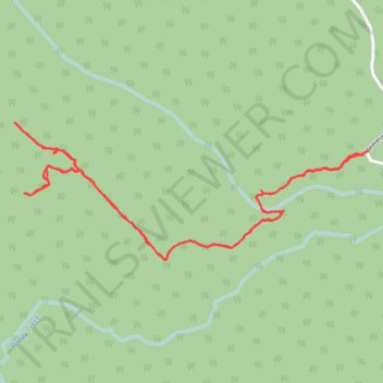
Beaverdam via Joachim's Trail
- Distance: 4.7 Km
- Elevation gain: 205 m
- Maximum elevation: 1,243 m
- Elevation loss: 206 m
- Minimum elevation: 1,088 m
- Moving time: 1 h 25 m
- Moving speed: 3.3 Km/h
- Maximum speed: 7.5 Km/h
- Total time: 1 h 45 m
- Global speed: 2.6 Km/h
Interactive trail map
Trail profile
- Distance: 4.7 Km
- Elevation gain: 205 m
- Maximum elevation: 1,243 m
- Elevation loss: 206 m
- Minimum elevation: 1,088 m
- Moving time: 1 h 25 m
- Moving speed: 3.3 Km/h
- Maximum speed: 7.5 Km/h
- Total time: 1 h 45 m
- Global speed: 2.6 Km/h
About this trail
Name: Beaverdam via Joachim's Trail trail, distance, elevation, map, profile, GPS track
Start: Beaverdam Road, Municipal District of Greenview, Alberta, Canada (53.92458 -119.19202)
End: Beaverdam Road, Municipal District of Greenview, Alberta, Canada (53.92468 -119.19175)
Coordinates: 53.92101 -119.21192 53.92561 -119.19175