
O'Leary Lookout Trail
- Distance: 8.1 Km
- Elevation gain: 627 m
- Maximum elevation: 2,711 m
- Elevation loss: 43 m
- Minimum elevation: 2,100 m
- Moving time: 1 h 41 m
- Moving speed: 4.8 Km/h
- Maximum speed: 12.6 Km/h
- Total time: 1 h 48 m
- Global speed: 4.5 Km/h
Interactive trail map
Trail profile
- Distance: 8.1 Km
- Elevation gain: 627 m
- Maximum elevation: 2,711 m
- Elevation loss: 43 m
- Minimum elevation: 2,100 m
- Moving time: 1 h 41 m
- Moving speed: 4.8 Km/h
- Maximum speed: 12.6 Km/h
- Total time: 1 h 48 m
- Global speed: 4.5 Km/h
About this trail
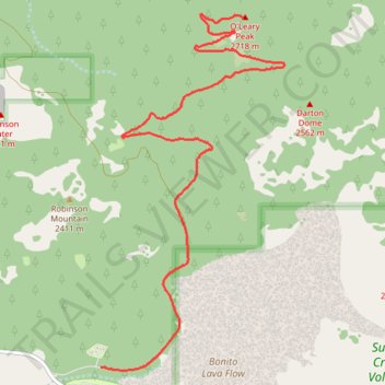
Name: O'Leary Lookout Trail trail, distance, elevation, map, profile, GPS track
Start: Forest Service 545A Road, Coconino County, Arizona, 86004, United States (35.37190 -111.54128)
Coordinates: 35.37164 -111.54128 35.40174 -111.52221