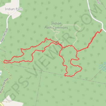
Indian Path Trail
#Hiking #Wilderness #Backcountry
- Distance: 5.3 Km
- Elevation gain: 90 m
- Maximum elevation: 64 m
- Elevation loss: 90 m
- Minimum elevation: 8 m
- Moving time: 1 h 29 m
- Moving speed: 3.5 Km/h
- Maximum speed: 7.3 Km/h
- Total time: 2 h 6 m
- Global speed: 2.5 Km/h
Interactive trail map
Trail profile
- Distance: 5.3 Km
- Elevation gain: 90 m
- Maximum elevation: 64 m
- Elevation loss: 90 m
- Minimum elevation: 8 m
- Moving time: 1 h 29 m
- Moving speed: 3.5 Km/h
- Maximum speed: 7.3 Km/h
- Total time: 2 h 6 m
- Global speed: 2.5 Km/h
About this trail
Name: Indian Path Trail trail, distance, elevation, map, profile, GPS track
Coordinates: 44.30660 -64.34323 44.31275 -64.32519