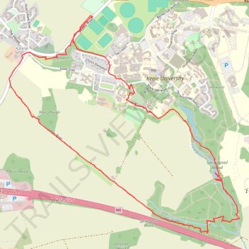
Loop Walk near Memorial Garden
- Distance: 6.9 Km
- Elevation gain: 93 m
- Maximum elevation: 205 m
- Elevation loss: 93 m
- Minimum elevation: 146 m
Interactive trail map
Trail profile
- Distance: 6.9 Km
- Elevation gain: 93 m
- Maximum elevation: 205 m
- Elevation loss: 93 m
- Minimum elevation: 146 m
About this trail
Name: Loop Walk near Memorial Garden trail, distance, elevation, map, profile, GPS track
Coordinates: 52.99053 -2.28921 53.00617 -2.26178