Import a GPX file

Yates Mountain

Barrier Lake. Bow Valley Wildland Provincial Park. #Hiking #Snowshoeing #MTB #Mountain #Lake #Forest #Yates

  • Distance: 11.7 Km
  • Elevation gain: 649 m
  • Maximum elevation: 2,005 m
  • Elevation loss: 649 m
  • Minimum elevation: 1,370 m

Interactive trail map

Trail profile

  • Distance: 11.7 Km
  • Elevation gain: 649 m
  • Maximum elevation: 2,005 m
  • Elevation loss: 649 m
  • Minimum elevation: 1,370 m

About this trail

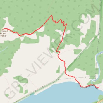
Name: Yates Mountain trail, distance, elevation, map, profile, GPS track

Start: Barrier Lake Road, Kananaskis Improvement District, Alberta, Canada (51.03246 -115.03904)

End: Barrier Lake Road, Kananaskis Improvement District, Alberta, Canada (51.03246 -115.03904)

Coordinates: 51.03246 -115.07956 51.05178 -115.03904

Gear up for your next adventure:

🛌Sleeping Mats - Insulated mats for camping comfort
🥾Hiking Shoes - Lightweight hiking shoes for day hikes
🩹Blister Prevention Tape - Apply to friction points before they become painful sores
Altimeter Barometer Watches - Outdoor watches with built-in sensors to track altitude changes and weather shifts
🧼Clip-on Hand Sanitizer - Maintain hygiene when water for washing is scarce

As an Amazon Associate, this site earns from qualifying purchases at no extra cost to you.