Rummel Ridge
Spray Valley Provincial Park. #Hiking #Snowshoeing #Loop #SprayValley
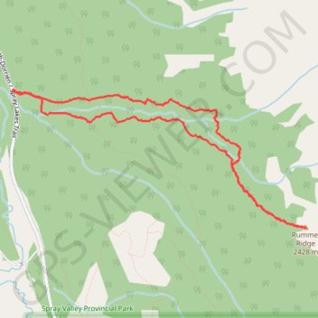
- Distance: 6.9 Km
- Elevation gain: 631 m
- Maximum elevation: 2,436 m
- Elevation loss: 630 m
- Minimum elevation: 1,811 m
Interactive trail map
Trail profile
- Distance: 6.9 Km
- Elevation gain: 631 m
- Maximum elevation: 2,436 m
- Elevation loss: 630 m
- Minimum elevation: 1,811 m
About this trail
Name: Rummel Ridge trail, distance, elevation, map, profile, GPS track
Start: Rummel Ridge Trail, Kananaskis Improvement District, Alberta, Canada (50.85073 -115.34437)
End: Rummel Ridge Trail, Kananaskis Improvement District, Alberta, Canada (50.85071 -115.34432)
Coordinates: 50.84040 -115.34455 50.85079 -115.30940