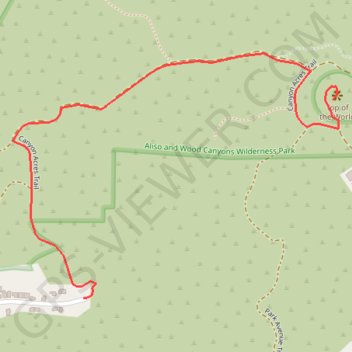
Top of the World
Interactive trail map
Trail profile
- Distance: 1.9 Km
- Elevation gain: 255 m
- Maximum elevation: 312 m
- Elevation loss: 6 m
- Minimum elevation: 62 m
About this trail
Name: Top of the World trail, distance, elevation, map, profile, GPS track
Coordinates: 33.55293 -117.76981 33.55856 -117.76082
Other hiking, mountain biking, running and outdoor activity trails
Click on a trail to view its statistics, map and profile.
Car Wreck Trail
United States > California > Orange County > Laguna Beach > Top of the World
Loop hike on the Car Wreck Trail from Alta Laguna Park via West Ridge Trail, Mathis Canyon Trail and Top of the World in the Aliso and Wood Canyons Wilderness Park. #Hiking #Loop #Nature #Mountain #Forest #Wilderness #Park #Pacific #Ocean #Sea
Distance: 5.8 Km • Elevation gain: 261 m • Maximum elevation: 312 m