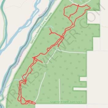
Brandt Pine Trails
- Distance: 15.6 Km
- Elevation gain: 42 m
- Maximum elevation: 287 m
- Elevation loss: 42 m
- Minimum elevation: 278 m
- Moving time: 1 h 15 m
- Moving speed: 12.4 Km/h
- Maximum speed: 40.9 Km/h
- Total time: 1 h 32 m
- Global speed: 10.1 Km/h
Interactive trail map
Trail profile
- Distance: 15.6 Km
- Elevation gain: 42 m
- Maximum elevation: 287 m
- Elevation loss: 42 m
- Minimum elevation: 278 m
- Moving time: 1 h 15 m
- Moving speed: 12.4 Km/h
- Maximum speed: 40.9 Km/h
- Total time: 1 h 32 m
- Global speed: 10.1 Km/h
About this trail
Name: Brandt Pine Trails trail, distance, elevation, map, profile, GPS track
Coordinates: 45.86012 -92.72963 45.88734 -92.70122