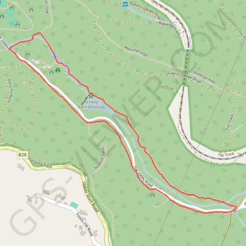
Valley Loop Hike
- Distance: 3.0 Km
- Elevation gain: 58 m
- Maximum elevation: 329 m
- Elevation loss: 58 m
- Minimum elevation: 283 m
Interactive trail map
Trail profile
- Distance: 3.0 Km
- Elevation gain: 58 m
- Maximum elevation: 329 m
- Elevation loss: 58 m
- Minimum elevation: 283 m
About this trail
Name: Valley Loop Hike trail, distance, elevation, map, profile, GPS track
Coordinates: -35.01784 138.64552 -35.01020 138.65729
Topography: Adelaide topographic map, elevation, terrain
Other hiking, mountain biking, running and outdoor activity trails
Click on a trail to view its statistics, map and profile.
Belair National Park - Mount Lofty
Australia > South Australia > Adelaide
#Bike
Distance: 13.0 Km • Elevation gain: 503 m • Maximum elevation: 704 m