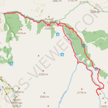
Vereda de la Estrella Loop
- Distance: 22.3 Km
- Elevation gain: 1,319 m
- Maximum elevation: 1,817 m
- Elevation loss: 1,325 m
- Minimum elevation: 1,161 m
Interactive trail map
Trail profile
- Distance: 22.3 Km
- Elevation gain: 1,319 m
- Maximum elevation: 1,817 m
- Elevation loss: 1,325 m
- Minimum elevation: 1,161 m
About this trail
Name: Vereda de la Estrella Loop trail, distance, elevation, map, profile, GPS track
Coordinates: 37.09104 -3.39016 37.13462 -3.32480
Other hiking, mountain biking, running and outdoor activity trails
Click on a trail to view its statistics, map and profile.
Southern section — European Divide Trail
France > Auvergne-Rhône-Alpes > Drôme > Valence
Distance: 2,423.8 Km • Elevation gain: 42,375 m • Maximum elevation: 2,005 m