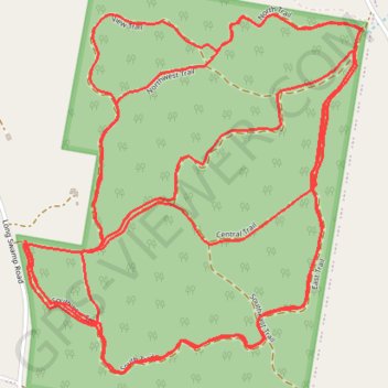
Imbota Nature Reserve
Imbota Trail Run
- Distance: 15.7 Km
- Elevation gain: 393 m
- Maximum elevation: 1,059 m
- Elevation loss: 394 m
- Minimum elevation: 989 m
- Moving time: 1 h 29 m
- Moving speed: 10.5 Km/h
- Maximum speed: 19.0 Km/h
- Total time: 1 h 36 m
- Global speed: 9.8 Km/h
Interactive trail map
Trail profile
- Distance: 15.7 Km
- Elevation gain: 393 m
- Maximum elevation: 1,059 m
- Elevation loss: 394 m
- Minimum elevation: 989 m
- Moving time: 1 h 29 m
- Moving speed: 10.5 Km/h
- Maximum speed: 19.0 Km/h
- Total time: 1 h 36 m
- Global speed: 9.8 Km/h
About this trail
Name: Imbota Nature Reserve trail, distance, elevation, map, profile, GPS track
Coordinates: -30.58164 151.71178 -30.56757 151.72722
Topography: Armidale topographic map, elevation, terrain