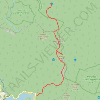
Rocky Valley Storage to Ropers Hut via Mount Nelse in Australian Alps
- Distance: 11.3 Km
- Elevation gain: 294 m
- Maximum elevation: 1,879 m
- Elevation loss: 207 m
- Minimum elevation: 1,611 m
- Moving time: 2 h 29 m
- Moving speed: 4.5 Km/h
- Maximum speed: 5.5 Km/h
- Total time: 2 h 46 m
- Global speed: 4.1 Km/h
Interactive trail map
Trail profile
- Distance: 11.3 Km
- Elevation gain: 294 m
- Maximum elevation: 1,879 m
- Elevation loss: 207 m
- Minimum elevation: 1,611 m
- Moving time: 2 h 29 m
- Moving speed: 4.5 Km/h
- Maximum speed: 5.5 Km/h
- Total time: 2 h 46 m
- Global speed: 4.1 Km/h
About this trail
Name: Rocky Valley Storage to Ropers Hut via Mount Nelse in Australian Alps trail, distance, elevation, map, profile, GPS track
Start: Big River Firetrail, Falls Creek, Alpine Shire, Victoria, Australia (-36.87337 147.31780)
Coordinates: -36.87340 147.31780 -36.81020 147.34219
Topography: Victoria topographic map, elevation, terrain
Other hiking, mountain biking, running and outdoor activity trails
Click on a trail to view its statistics, map and profile.
Mount Bogong from Cleve Cole Hut to Ropers Hut in Australian Alps
Distance: 23.2 Km • Elevation gain: 1,031 m • Maximum elevation: 1,984 m
Ropers Hut to Cleve Cole Hut via Howman Falls in Bogong Natural Area
Distance: 12.5 Km • Elevation gain: 888 m • Maximum elevation: 1,770 m
Rocky Valley Storage to Cope Hut in Austalian Alps
Distance: 16.1 Km • Elevation gain: 411 m • Maximum elevation: 1,777 m