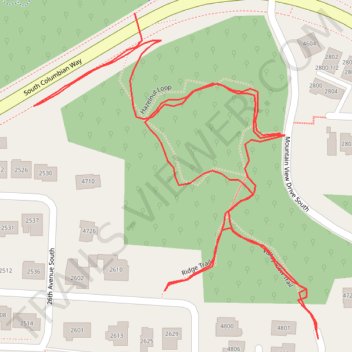
Cheasty Greenspace trails and links south of Columbian Way
- Distance: 1.2 Km
- Elevation gain: 34 m
- Maximum elevation: 98 m
- Elevation loss: 36 m
- Minimum elevation: 71 m
- Moving time: 18 m 38 s
- Moving speed: 3.7 Km/h
- Maximum speed: 10.2 Km/h
- Total time: 23 m 32 s
- Global speed: 2.9 Km/h
Interactive trail map
Trail profile
- Distance: 1.2 Km
- Elevation gain: 34 m
- Maximum elevation: 98 m
- Elevation loss: 36 m
- Minimum elevation: 71 m
- Moving time: 18 m 38 s
- Moving speed: 3.7 Km/h
- Maximum speed: 10.2 Km/h
- Total time: 23 m 32 s
- Global speed: 2.9 Km/h
About this trail
Name: Cheasty Greenspace trails and links south of Columbian Way trail, distance, elevation, map, profile, GPS track
Coordinates: 47.55951 -122.29949 47.56154 -122.29686