Ladhak Trek
Darcha, Panjilla, Chilling. #Hiking
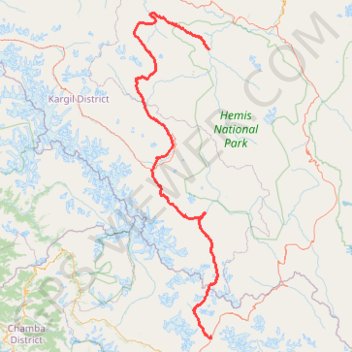
- Distance: 342.2 Km
- Elevation gain: 14,524 m
- Maximum elevation: 5,043 m
- Elevation loss: 14,731 m
- Minimum elevation: 3,189 m
Interactive trail map
Trail profile
- Distance: 342.2 Km
- Elevation gain: 14,524 m
- Maximum elevation: 5,043 m
- Elevation loss: 14,731 m
- Minimum elevation: 3,189 m
About this trail
Name: Ladhak Trek trail, distance, elevation, map, profile, GPS track
Start: Main Road Yoche, Darcha, Lahul, Lahaul and Spiti, Himachal Pradesh, India (32.67250 77.21608)
End: Bavo Thang, Manual river crossing pulley, Leh district, Ladakh, India (34.03832 77.20070)
Coordinates: 32.67040 76.77614 34.20876 77.25107
Other hiking, mountain biking, running and outdoor activity trails
Click on a trail to view its statistics, map and profile.