Import a GPX file

Kanaka Creek - Cliff Falls

Kanaka Creek Regional Park. #Hiking #Loop #KanakaCreek

  • Distance: 2.6 Km
  • Elevation gain: 45 m
  • Maximum elevation: 91 m
  • Elevation loss: 45 m
  • Minimum elevation: 60 m

Interactive trail map

Trail profile

  • Distance: 2.6 Km
  • Elevation gain: 45 m
  • Maximum elevation: 91 m
  • Elevation loss: 45 m
  • Minimum elevation: 60 m

About this trail

Other hiking, mountain biking, running and outdoor activity trails

Click on a trail to view its statistics, map and profile.
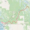
Vancouver - Golden

Canada > British Columbia > Metro Vancouver Regional District > Vancouver

#Bike #Vancouver #Golden

Distance: 827.6 Km • Elevation gain: 9,376 m • Maximum elevation: 1,347 m

Vancouver - Mission

Canada > British Columbia > Metro Vancouver Regional District > Richmond

#Bike #Vancouver #Mission

Distance: 72.6 Km • Elevation gain: 391 m • Maximum elevation: 44 m

Gear up for your next adventure:

🧼Biodegradable Soap - Eco-friendly outdoor soap
🧣Merino Neck Gaiters - Versatile headwear for warmth, sun protection, or dust filtering
🎒40L Day Hiking Backpacks - Comfortable packs with hydration support for long days exploring topographic peaks
🖼️Scratch-off Australia Map - Track the regions and peaks you have explored geographically
🧥Insulated Down Jackets - High warmth-to-weight ratio for cold nights in the high country

As an Amazon Associate, this site earns from qualifying purchases at no extra cost to you.