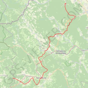
ViaTransilvanica
- Distance: 136.7 Km
- Elevation gain: 4,690 m
- Maximum elevation: 1,328 m
- Elevation loss: 4,344 m
- Minimum elevation: 543 m
Interactive trail map
Trail profile
- Distance: 136.7 Km
- Elevation gain: 4,690 m
- Maximum elevation: 1,328 m
- Elevation loss: 4,344 m
- Minimum elevation: 543 m
About this trail
Name: ViaTransilvanica trail, distance, elevation, map, profile, GPS track
Start: SV 001, Strada Principală, Putna, 727455, Romania (47.86608 25.59815)
End: BN 002, DJ172D, Lunca Ilvei, Bistrița-Năsăud, 727436, Romania (47.34603 25.05703)
Coordinates: 47.29881 25.05703 47.87090 25.71035