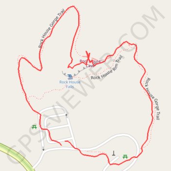
Rock House Cave and Falls Loop via Rock House Gorge Trail in Hocking Hills State Park
The Rock House Cave and Falls Loop offers a unique hiking experience characterized by stunning natural features and rich history. The loop trail leads you to the impressive Rock House, a sandstone cave with Gothic-arched windows and evidence of past human habitation, making it a fascinating stop for both nature enthusiasts and history buffs. Along the way, expect scenic vistas of the gorge, lush greenery, and, depending on the season, the allure of cascading waterfalls, particularly impressive in the spring. #Hiking #Loop #Gorge #Cave #Waterfall #Forest #Nature
- Distance: 1.5 Km
- Elevation gain: 54 m
- Maximum elevation: 351 m
- Elevation loss: 54 m
- Minimum elevation: 308 m
- Moving time: 28 m 38 s
- Moving speed: 3.1 Km/h
- Maximum speed: 7.6 Km/h
- Total time: 37 m 22 s
- Global speed: 2.4 Km/h
Interactive trail map
Trail profile
About this trail
Name: Rock House Cave and Falls Loop via Rock House Gorge Trail in Hocking Hills State Park trail, distance, elevation, map, profile, GPS track
Start: Rock House Rim Trail, Hocking County, Ohio, United States (39.49587 -82.61429)
End: Rock House Rim Trail, Hocking County, Ohio, United States (39.49578 -82.61439)
Coordinates: 39.49537 -82.61559 39.49877 -82.61185
Other hiking, mountain biking, running and outdoor activity trails
Click on a trail to view its statistics, map and profile.
Hocking Hills Rock House Trail
United States > Ohio > Hocking County
Distance: 1.0 Km • Elevation gain: 43 m • Maximum elevation: 338 m