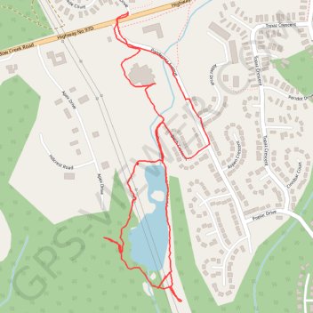
Logan Lake Marsh Loop
Interactive trail map
Trail profile
- Distance: 3.2 Km
- Elevation gain: 48 m
- Maximum elevation: 1,086 m
- Elevation loss: 47 m
- Minimum elevation: 1,065 m
- Moving time: 54 m 50 s
- Moving speed: 3.5 Km/h
- Maximum speed: 9.3 Km/h
- Total time: 1 h 7 s
- Global speed: 3.2 Km/h
About this trail
Name: Logan Lake Marsh Loop trail, distance, elevation, map, profile, GPS track
Coordinates: 50.48279 -120.81764 50.49109 -120.81287
Other hiking, mountain biking, running and outdoor activity trails
Click on a trail to view its statistics, map and profile.