Sawmill Mountain and Mount Pinos
Hike to Sawmill Mountain via Mount Pinos Condor Observation Site from Chula Vista Parking in the Chumash Wilderness. #Hiking #Mountain #Nature #Forest #Wilderness
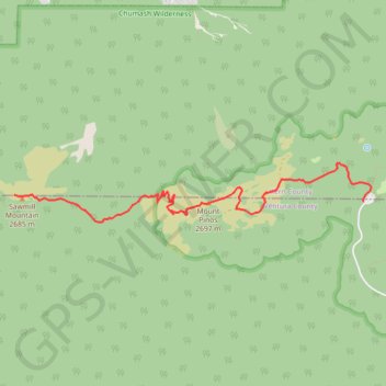
- Distance: 6.0 Km
- Elevation gain: 311 m
- Maximum elevation: 2,692 m
- Elevation loss: 185 m
- Minimum elevation: 2,548 m
Interactive trail map
Trail profile
- Distance: 6.0 Km
- Elevation gain: 311 m
- Maximum elevation: 2,692 m
- Elevation loss: 185 m
- Minimum elevation: 2,548 m
About this trail
Name: Sawmill Mountain and Mount Pinos trail, distance, elevation, map, profile, GPS track
End: Vincent Tumamait Trail, Ventura County, California, 93222, United States (34.81364 -119.16798)
Coordinates: 34.81098 -119.16798 34.81666 -119.12625