
Cook Street Trail to Bantry Bay
- Distance: 5.1 Km
- Elevation gain: 129 m
- Maximum elevation: 124 m
- Elevation loss: 134 m
- Minimum elevation: 5 m
- Moving time: 1 h 5 m
- Moving speed: 4.7 Km/h
- Maximum speed: 14.5 Km/h
- Total time: 2 h 46 m
- Global speed: 1.8 Km/h
Interactive trail map
Trail profile
- Distance: 5.1 Km
- Elevation gain: 129 m
- Maximum elevation: 124 m
- Elevation loss: 134 m
- Minimum elevation: 5 m
- Moving time: 1 h 5 m
- Moving speed: 4.7 Km/h
- Maximum speed: 14.5 Km/h
- Total time: 2 h 46 m
- Global speed: 1.8 Km/h
About this trail
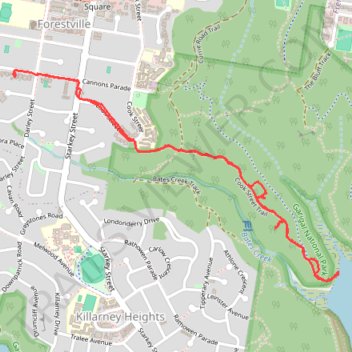
Name: Cook Street Trail to Bantry Bay trail, distance, elevation, map, profile, GPS track
Coordinates: -33.77358 151.21236 -33.76418 151.22981
Topography: Sydney topographic map, elevation, terrain