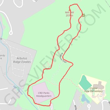
Import a GPX file

Mill Hill Loop

Vancouver Island. Mill Hill Regional Park. #Hiking #Loop #MillHill #Vancouver

  • Distance: 1.8 Km
  • Elevation gain: 113 m
  • Maximum elevation: 195 m
  • Elevation loss: 113 m
  • Minimum elevation: 81 m

Interactive trail map

Trail profile

  • Distance: 1.8 Km
  • Elevation gain: 113 m
  • Maximum elevation: 195 m
  • Elevation loss: 113 m
  • Minimum elevation: 81 m

About this trail

Gear up for your next adventure:

🔪Outdoor Multi-tools - Versatile tools for gear repair and survival tasks in the wilderness
🧊Insulated Cooler Bags - Keep food fresh for day trips to remote geographic sites
🌬️Windbreaker Jackets - Wind protection jackets
🏫Topographic World Globes - 3D physical relief globes to understand global geography
🔋Rechargeable Batteries - Eco-friendly power for high-drain GPS units and flashlights

As an Amazon Associate, this site earns from qualifying purchases at no extra cost to you.