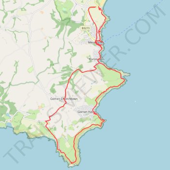
Mevagissey - Gorran
- Distance: 24.7 Km
- Elevation gain: 877 m
- Maximum elevation: 112 m
- Elevation loss: 869 m
- Minimum elevation: 0 m
- Moving time: 7 h 24 s
- Moving speed: 3.5 Km/h
- Maximum speed: 6.6 Km/h
- Total time: 8 h 8 m
- Global speed: 3.0 Km/h
Interactive trail map
Trail profile
- Distance: 24.7 Km
- Elevation gain: 877 m
- Maximum elevation: 112 m
- Elevation loss: 869 m
- Minimum elevation: 0 m
- Moving time: 7 h 24 s
- Moving speed: 3.5 Km/h
- Maximum speed: 6.6 Km/h
- Total time: 8 h 8 m
- Global speed: 3.0 Km/h
About this trail
Name: Mevagissey - Gorran trail, distance, elevation, map, profile, GPS track
Start: B3273, Pentewan Valley, Mevagissey, Cornwall, England, PL26 6EH, United Kingdom (50.28428 -4.78547)
End: B3273, Trewinney Barton, Mevagissey, Cornwall, England, PL26 6EH, United Kingdom (50.28402 -4.78729)
Coordinates: 50.21989 -4.81963 50.28428 -4.76869