Mount Major Trail and Brook Trail Loop in Major Mountain State Forest
The Mount Major Trail and Brook Trail Loop offers an enjoyable and scenic hike suitable for most skill levels. The route features breathtaking panoramic views of Lake Winnipesaukee and the White Mountains from the summit, with opportunities to admire the lush forest, rocky outcroppings, and interesting vegetation along the way. While the ascent on Mount Major Trail can be challenging, particularly near the summit where it includes some rocky scrambles, the Brook Trail provides a gentler descent through beautiful woodlands and over stream crossings, making it a well-rounded hiking experience. #Hiking #Loop #Mountain #Forest #Nature
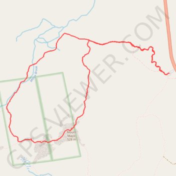
- Distance: 6.7 Km
- Elevation gain: 344 m
- Maximum elevation: 539 m
- Elevation loss: 345 m
- Minimum elevation: 203 m
- Moving time: 1 h 45 m
- Moving speed: 3.8 Km/h
- Maximum speed: 12.2 Km/h
- Total time: 2 h 5 m
- Global speed: 3.2 Km/h
Interactive trail map
Trail profile
- Distance: 6.7 Km
- Elevation gain: 344 m
- Maximum elevation: 539 m
- Elevation loss: 345 m
- Minimum elevation: 203 m
- Moving time: 1 h 45 m
- Moving speed: 3.8 Km/h
- Maximum speed: 12.2 Km/h
- Total time: 2 h 5 m
- Global speed: 3.2 Km/h
About this trail
Name: Mount Major Trail and Brook Trail Loop in Major Mountain State Forest trail, distance, elevation, map, profile, GPS track
Coordinates: 43.51223 -71.29642 43.52337 -71.27354
Other hiking, mountain biking, running and outdoor activity trails
Click on a trail to view its statistics, map and profile.
Mount Major Trail and Brook Trail Loop in Mount Major State Forest
United States > New Hampshire > Belknap County > Alton > Mount Major
The Mount Major Trail and Brook Trail Loop in Mount Major State Forest offers a rewarding hike with spectacular views of the surrounding lakes and forested landscape. The trail provides hikers with an opportunity to explore varied terrain, from rocky sections to lush woodland, all while ascending the peak for…
Distance: 6.6 Km • Elevation gain: 335 m • Maximum elevation: 536 m