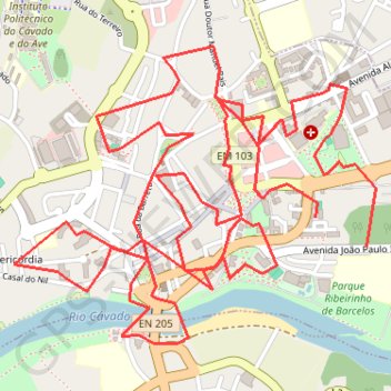
Portugal
- Distance: 8.7 Km
- Elevation gain: 164 m
- Maximum elevation: 49 m
- Elevation loss: 151 m
- Minimum elevation: 12 m
Interactive trail map
Trail profile
- Distance: 8.7 Km
- Elevation gain: 164 m
- Maximum elevation: 49 m
- Elevation loss: 151 m
- Minimum elevation: 12 m
About this trail
Name: Portugal trail, distance, elevation, map, profile, GPS track
Coordinates: 41.52676 -8.62813 41.53593 -8.61326
Other hiking, mountain biking, running and outdoor activity trails
Click on a trail to view its statistics, map and profile.
Camino Portugues Central
Portugal > Lisbon > Lisbon > Madalena
Lissabon - Porto: 347 km<br> Porto - Santiago: 242 km<br><br><a href="https://www.santiago.nl/product-categorie/gidsen/gidsen-portugal/">Gids</a><br>
Distance: 604.3 Km • Elevation gain: 8,290 m • Maximum elevation: 470 m
EuroVelo 1 (Por
Portugal > Viana do Castelo > Caminha > Terreiro
Distance: 1,156.4 Km • Elevation gain: 10,823 m • Maximum elevation: 254 m
Southern section — European Divide Trail
France > Auvergne-Rhône-Alpes > Drôme > Valence
Distance: 2,423.8 Km • Elevation gain: 42,375 m • Maximum elevation: 2,005 m
Portuguese Coastal Way
Distance: 196.8 Km • Elevation gain: 1,918 m • Maximum elevation: 181 m