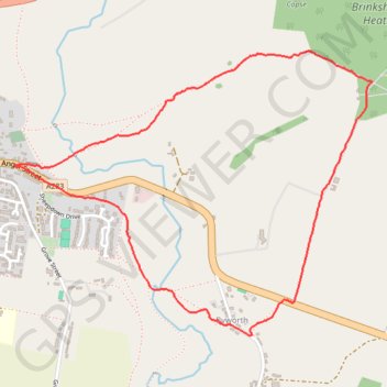
Petworth, Brinkshole Heath and Byworth loop
- Distance: 4.2 Km
- Elevation gain: 123 m
- Maximum elevation: 108 m
- Elevation loss: 123 m
- Minimum elevation: 22 m
- Moving time: 1 h 11 m
- Moving speed: 3.6 Km/h
- Maximum speed: 6.1 Km/h
- Total time: 1 h 12 m
- Global speed: 3.5 Km/h
Interactive trail map
Trail profile
- Distance: 4.2 Km
- Elevation gain: 123 m
- Maximum elevation: 108 m
- Elevation loss: 123 m
- Minimum elevation: 22 m
- Moving time: 1 h 11 m
- Moving speed: 3.6 Km/h
- Maximum speed: 6.1 Km/h
- Total time: 1 h 12 m
- Global speed: 3.5 Km/h
About this trail
Name: Petworth, Brinkshole Heath and Byworth loop trail, distance, elevation, map, profile, GPS track
Coordinates: 50.97992 -0.60738 50.99014 -0.58695