
Goldbug Hot Springs Trail in Salmon-Challis National Forest
The Goldbug Hot Springs Trail offers a moderate hike through stunning scenery, culminating in soothing geothermal pools nestled among rocky cliffs and lush vegetation. Along the route, hikers can enjoy beautiful waterfalls and panoramic views of the surrounding mountains, providing a rewarding backdrop to the experience. While the trail can be popular, especially on weekends, the natural beauty and the therapeutic springs make it a worthwhile adventure for those seeking relaxation in nature. #Hiking #Mountain #Forest #River #Nature
- Distance: 5.9 Km
- Elevation gain: 300 m
- Maximum elevation: 1,638 m
- Elevation loss: 301 m
- Minimum elevation: 1,351 m
- Moving time: 1 h 59 m
- Moving speed: 3.0 Km/h
- Maximum speed: 5.3 Km/h
- Total time: 3 h 12 m
- Global speed: 1.8 Km/h
Interactive trail map
Trail profile
- Distance: 5.9 Km
- Elevation gain: 300 m
- Maximum elevation: 1,638 m
- Elevation loss: 301 m
- Minimum elevation: 1,351 m
- Moving time: 1 h 59 m
- Moving speed: 3.0 Km/h
- Maximum speed: 5.3 Km/h
- Total time: 3 h 12 m
- Global speed: 1.8 Km/h
About this trail
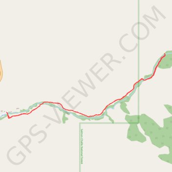
Name: Goldbug Hot Springs Trail in Salmon-Challis National Forest trail, distance, elevation, map, profile, GPS track
Start: Goldbug Hot Springs Trail, Lemhi County, Idaho, United States (44.89807 -113.95702)
End: Goldbug Hot Springs Trail, Lemhi County, Idaho, United States (44.89814 -113.95716)
Coordinates: 44.89739 -113.95716 44.90542 -113.92934