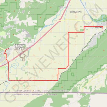
Lower Sumas Mountain - Yarrow
#Bike #LowerSumas #Yarrow
- Distance: 25.6 Km
- Elevation gain: 40 m
- Maximum elevation: 152 m
- Elevation loss: 164 m
- Minimum elevation: 0 m
Interactive trail map
Trail profile
- Distance: 25.6 Km
- Elevation gain: 40 m
- Maximum elevation: 152 m
- Elevation loss: 164 m
- Minimum elevation: 0 m
About this trail
Name: Lower Sumas Mountain - Yarrow trail, distance, elevation, map, profile, GPS track
Coordinates: 49.01685 -122.22779 49.08218 -122.04560
Other hiking, mountain biking, running and outdoor activity trails
Click on a trail to view its statistics, map and profile.
Tsawwassen - Chilliwack
Canada > British Columbia > Metro Vancouver Regional District
Distance: 98.7 Km • Elevation gain: 500 m • Maximum elevation: 126 m