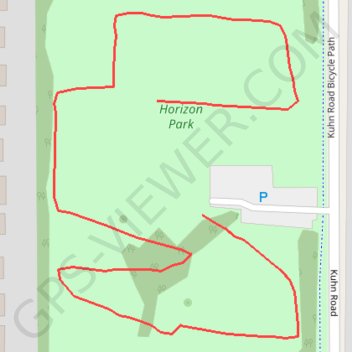
Horizon Park, Carol Stream
- Distance: 0.7 Km
- Elevation gain: 4 m
- Maximum elevation: 237 m
- Elevation loss: 5 m
- Minimum elevation: 232 m
- Moving time: 9 m 13 s
- Moving speed: 4.7 Km/h
- Maximum speed: 5.5 Km/h
- Total time: 9 m 13 s
- Global speed: 4.7 Km/h
Interactive trail map
Trail profile
- Distance: 0.7 Km
- Elevation gain: 4 m
- Maximum elevation: 237 m
- Elevation loss: 5 m
- Minimum elevation: 232 m
- Moving time: 9 m 13 s
- Moving speed: 4.7 Km/h
- Maximum speed: 5.5 Km/h
- Total time: 9 m 13 s
- Global speed: 4.7 Km/h
About this trail
Name: Horizon Park, Carol Stream trail, distance, elevation, map, profile, GPS track
Coordinates: 41.91427 -88.14199 41.91582 -88.14043