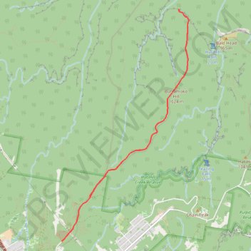
Burramoko Fire Trail - Hanging Rock
Blue Mountains National Park. #Hiking #MTB #Burramoko #HangingRock #BlueMountains
- Distance: 11.8 Km
- Elevation gain: 271 m
- Maximum elevation: 1,062 m
- Elevation loss: 271 m
- Minimum elevation: 913 m
Interactive trail map
Trail profile
- Distance: 11.8 Km
- Elevation gain: 271 m
- Maximum elevation: 1,062 m
- Elevation loss: 271 m
- Minimum elevation: 913 m
About this trail
Name: Burramoko Fire Trail - Hanging Rock trail, distance, elevation, map, profile, GPS track
Coordinates: -33.62116 150.28872 -33.58237 150.31416
Topography: New South Wales topographic map, elevation, terrain
Other hiking, mountain biking, running and outdoor activity trails
Click on a trail to view its statistics, map and profile.